Russ's Birthday Trip — Harris & Lewis
Dates: Fri 20th – Mon 23rd March 2026
Party: TBC
---
Transport
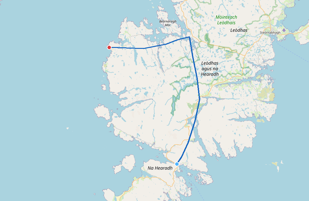
Outbound Ferry — Sat 21st March
- Route: Uig → Tarbert (Harris)
- Depart: 09:40 → Arrive: 11:20 (1h 40m)
- Booking: 3 adults + Audi A3, £71.50
- Ref: DFP194337189 (provisional — awaiting CalMac confirmation)
Return Ferry — Mon 23rd March
- Route: Stornoway → Ullapool
- Depart: 14:00 → Arrive: 16:40 (2h 40m)
- Booking: 3 adults + Audi A3, £112.50
- Ref: DFP194337926 (provisional — awaiting CalMac confirmation)
---
Plan
Day 0 — Fri 20th March
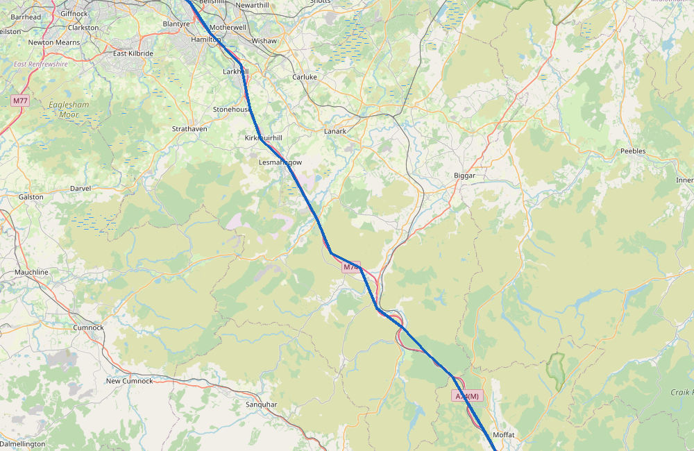
- 09:00 Leave Crewe
- Drive: Crewe → Uig area (~380 miles, 7-8h via M6/A74/A82)
- ~17:00-18:00 Arrive camping spot
- Stay: Wild camp near Uig (57.66623, -6.35726) — for early ferry
Day 1 — Sat 21st March
- 08:30 Leave camp (10 min drive to ferry)
- 09:40 Ferry: Uig → Tarbert (Harris)
- 11:20 Arrive Tarbert
- ~12:00 Drive: Tarbert → Callanish Stones (~35 miles, 50 min)
- 12:30-14:00 Explore Callanish Stones
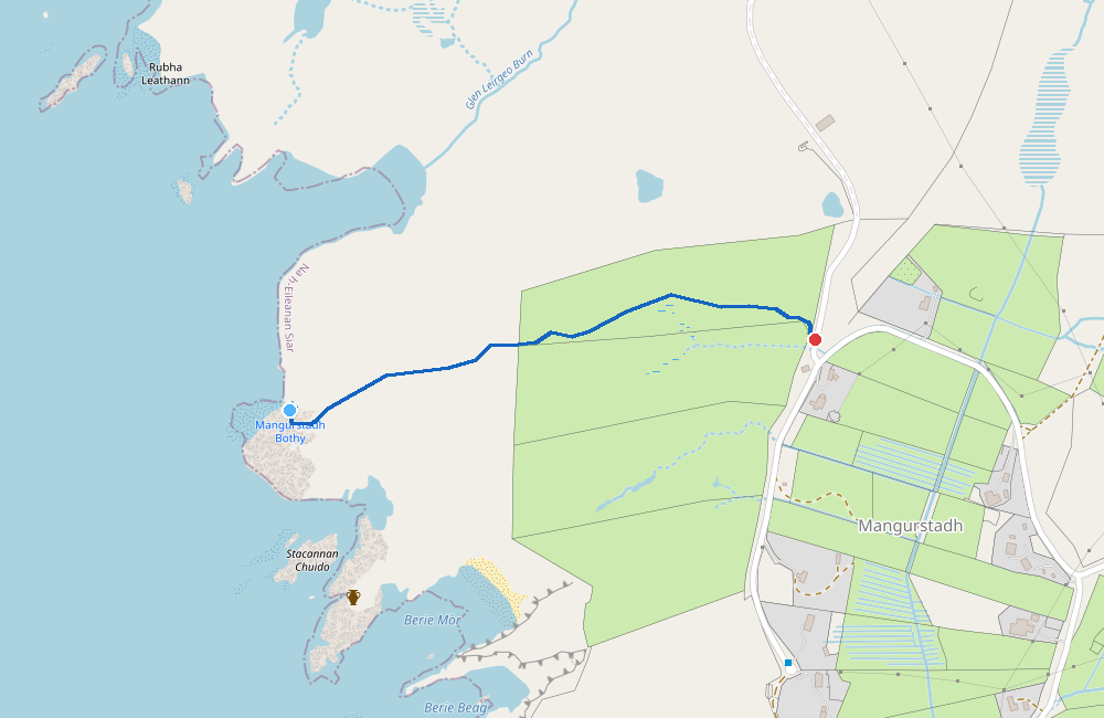
- ~14:30 Drive: Callanish → Mangersta parking (~20 miles, 35 min)
- 15:00 Check in at Norgroves (no. 3 Mangurstadh)
- Walk: parking → Mangersta bothy (0.7 km, ~15 min)
- Stay: Mangersta bothy (booked)
Day 2 — Sun 22nd March
- Leave Mangersta bothy
- Walk: bothy → parking (0.7 km, ~15 min)
- Explore / drive north into Lewis
- Options: Great Bernera, Little Bernera, beaches, wildlife
- Stay: Wild camp (see camping notes below)
Day 3 — Mon 23rd March
- Drive to Stornoway (allow time for ferry)
- 14:00 Ferry: Stornoway → Ullapool
- 16:40 Arrive Ullapool
- Drive: Ullapool → Crewe (~6h)
- ~23:00 Arrive Crewe
---
Places
Crewe (home)
- Coordinates: 53.0977, -2.4407
Friday night camping
- Coordinates: 57.66623, -6.35726
- Near Uig, approx 10 min from ferry terminal
Uig Ferry Terminal
- Coordinates: 57.5854, -6.3566
- CalMac terminal for Tarbert crossing
Callanish Stones (Calanais)
- Coordinates: 58.197541, -6.745145
- Neolithic stone circle (~2750 BCE), one of the most impressive prehistoric sites in Britain
- Cross-shaped layout with tall central monolith and multiple stone rows
- Overlooks Loch Roag with Great Bernera hills as backdrop
- Nearby: Callanish II and III stone circles within walking distance
- Visitor centre with café — free to visit stones, centre has exhibits
- Allow 1-2 hours to explore main site + surroundings
Mangersta bothy
- Parking: 58.17235, -7.10157 (what3words
///waitress.sheepish.surreal) - Bothy: 58.17308, -7.09135
- Check-in: Call at Norgrove house (no. 3 Mangurstadh — big number 3 on gate) before going to bothy
- If Norgroves not in: Check outbuilding next to house (twin turquoise cones, turf roof) for directions
Stornoway Ferry Terminal
- Coordinates: 58.2093, -6.3869
- CalMac terminal for Ullapool crossing
---
Great Bernera & Little Bernera
Great Bernera
- Connected to Lewis by bridge — easy to visit
- Bosta Beach — stunning white sand beach at end of road, one of the best on Lewis
- Iron Age House — replica at Bosta, original was uncovered by 1992 storm (visit May-Sep, Mon-Sat 12-4pm)
- Time and Tide Bell — art installation revealed at low tide
- Great Bernera Trail — half-day walk from Valasay through Tobson to Bosta (faint/wet paths)
- Lewisian Gneiss — beach scattered with some of Earth's oldest rocks (3 billion years old)
- Ideal for walking, fishing, birdwatching
- Views: From hills above Bosta, see ~40 islands in Loch Roag, possibly Flannan Isles on horizon
Little Bernera
- Small uninhabited island (~1 mile × 0.5 mile) opposite north end of Great Bernera
- Access: By boat only, no regular service
- More for looking at than visiting — visible from Great Bernera
---
Wildlife & Nature
Birds of Prey
- Golden Eagles — resident in Harris hills; most active mornings/evenings
- White-tailed (Sea) Eagles — reintroduced, seen along coasts
- North Harris Eagle Observatory — 2km walk up Glen Meavaig from car park on Huisinis road; within golden eagle territory
- Hen Harriers — on moorland
Marine Life
- Grey and Harbour Seals — common in sea lochs and around coasts
- Otters — shy but present in sea lochs; early morning best
- Bottlenose and Common Dolphins — offshore
- Minke Whales — occasionally seen offshore
Notable Areas
- Mangersta coastline — dramatic cliffs, sea stacks; watch for seabirds
- Luskentyre & Seilebost — at low tide, vast sand flats attract waders
- Loch Roag area — good for seals and otters
- North Harris hills — eagle territory, red deer
Tips
- Binoculars essential
- Early morning best for otters and eagles
- Check tide times for Bosta beach and coastal walks
---
Other Places Worth Seeing
Beaches (from webpage reference)
- Luskentyre — one of the best beaches in Britain, vast white sands, turquoise water
- Seilebost — adjacent to Luskentyre, stunning at low tide when sands almost meet
- Scarista — long sweep backed by dunes, great views
- Reef Beach (Traigh na Beirigh) — west Lewis, hidden gem with wild camping behind
- Garry Beach — east coast Lewis, unusual landscape, rock arches at low tide
- Huisinis — end of scenic road in North Harris, dramatic bright white beach
Scenic Drives
- The Golden Road — east Harris coast, twisting single track through rocky moonscape
- Road to Huisinis — 13 miles of scenic single track, challenging but worth it
---
Sunday Night Camping
Weather Considerations
Sunday forecast shows winds picking up (35+ km/h from WSW). Consider:
If winds are from west/southwest (as forecast):
- East coast Lewis more sheltered — try Garry Beach area or Tolsta
- East Harris (Golden Road area) also more sheltered but fewer flat spots
If winds are light:
- West coast options near beaches (Reef Beach area has good wild camping behind dunes)
- Great Bernera — Bosta area
Backup:
- Stornoway area — closer to Monday ferry, campsites available
- East side of island generally drier and more sheltered from prevailing winds
---
Weather Forecast
*Updated: Wed 18th March 2026*
Lewis/Harris Area (Callanish)
| Day | Date | Temp | Wind | Precip | Conditions |
|-----|------|------|------|--------|------------|
| Fri | 20th | 3-14°C | 10 km/h WSW | 1.0mm | Light drizzle AM, clearing |
| Sat | 21st | 7-9°C | 34 km/h WSW | 1.2mm | Light drizzle, breezy |
| Sun | 22nd | 4-9°C | 38 km/h W | 12.5mm | Moderate rain, windy |
Harris (Tarbert area)
| Day | Date | Temp | Wind | Precip | Conditions |
|-----|------|------|------|--------|------------|
| Fri | 20th | 7-11°C | 10 km/h WSW | 0.7mm | Light drizzle, mostly dry |
| Sat | 21st | 6-8°C | 35 km/h WSW | 1.2mm | Light drizzle, windy |
| Sun | 22nd | 3-8°C | 41 km/h W | 15.5mm | Heavy rain, very windy |
Summary
- Friday: Good driving weather, mild
- Saturday: Manageable — breezy with light drizzle, OK for exploring and bothy
- Sunday: Deteriorating — heavier rain and strong winds arriving; plan for sheltered camp spot on east side
- Camping: Bring good wind-resistant tent setup, consider east coast Sunday night
---
Bookings & References
Ferries (Direct Ferries / CalMac)
- Outbound: DFP194337189 — Uig → Tarbert, Sat 21 Mar 09:40 (£71.50, provisional)
- Return: DFP194337926 — Stornoway → Ullapool, Mon 23 Mar 14:00 (£112.50, provisional)
- Confirmation emails to: rbrooks.plh@proton.me
Mangersta bothy (night of 21st March)
- Status: ✅ Booked
- Contact: Jennifer Fearon (Linda Norgrove Foundation)
- Donation: £20/person suggested (donation box in outbuilding or lindanorgrovefoundation.org/donate)
- Cancellation: Email to change/cancel
Instructions from booking:
- Call at Norgrove house (no. 3 Mangurstadh) BEFORE going to bothy — they want to meet visitors and give directions
- Press doorbell a couple of times
- If not in: directions in outbuilding (turquoise cones + turf roof)
- Use toilet in outbuilding
- Bring kindling-size wood (no coal) — chimney can smoke with bigger pieces; leave door open if it smokes
- DO NOT tweet or post on social media — they want to preserve the isolation
- Clean up well, take all rubbish, bring own towel
---
Notes
- Beth not travelling (assume pet care needed)
- Wild camping gear needed for Fri + Sun nights
- Ferry check-in typically 30-45 min before departure
- Bring binoculars for wildlife
- Check tide times for beach visits (especially Bosta, Garry Beach)